
Gridded Weather
Gridded Weather products provide spatial weather information used to support fire danger assessment, planning, and situational awareness.
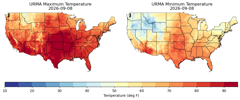
Max/Min Temperature
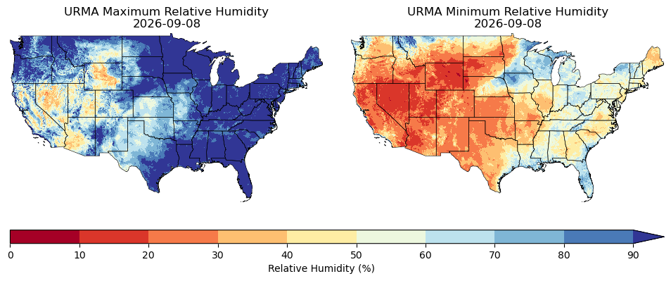
Max/Min Relative Humidity
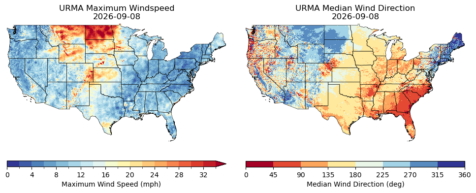
Max Wind Speed / Median Wind Direction
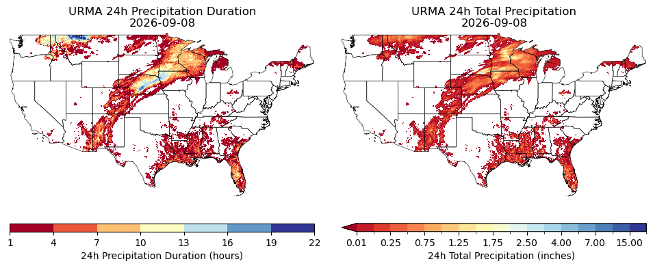
24h Precipitation Duration / 24h Total Precipitation
Drought
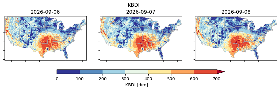
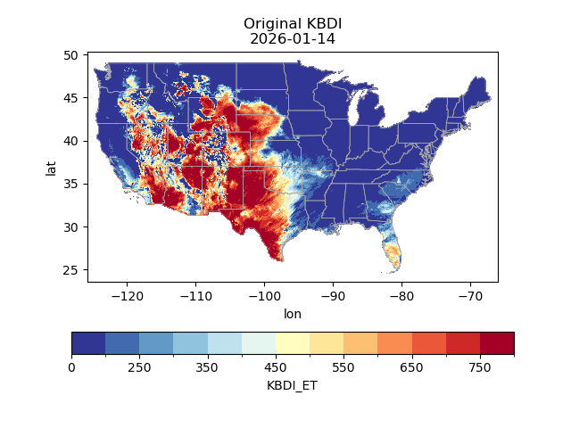
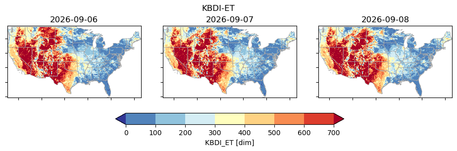
Drought products include the traditional Keetch-Byram Drought Index calculated from URMA data, as well as a prototype KBDI calculated using a new algorithm based on a more complete water balance.
Traditional KBDI from URMA
Current Traditional KBDI from URMA
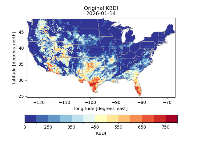
Traditional KBDI from URMA — Last 3 Days
Prototype Water-Balance KBDI
Current Prototype Water-Balance KBDI
Prototype Water-Balance KBDI — Last 3 Days
About WFAS
WFAS is an integrated, web-based platform providing real-time and forecasted national views of fire weather and fire potential across the United States. Access critical data, including:
- National Fire Danger Ratings, NFDRS
- Moisture Estimates, from 1-hour to 1000-hour
- Drought Indices, including Keetch-Byram and Palmer
- Satellite-Derived Vegetation Conditions
Whether you are a wildland firefighter, local, regional or national fire manager, industry risk manager, or concerned citizen, WFAS provides the multi-temporal and multi-spatial insights needed to support informed fire management decisions and reduce potential wildfire risk.